Android · Coming September 2026

Two routes.
You choose.

RedactedRoute is turn-by-turn navigation that shows every ALPR camera in the country — and routes you around them. Every trip. Every time.

Google Play · Sep 2026 See how it works
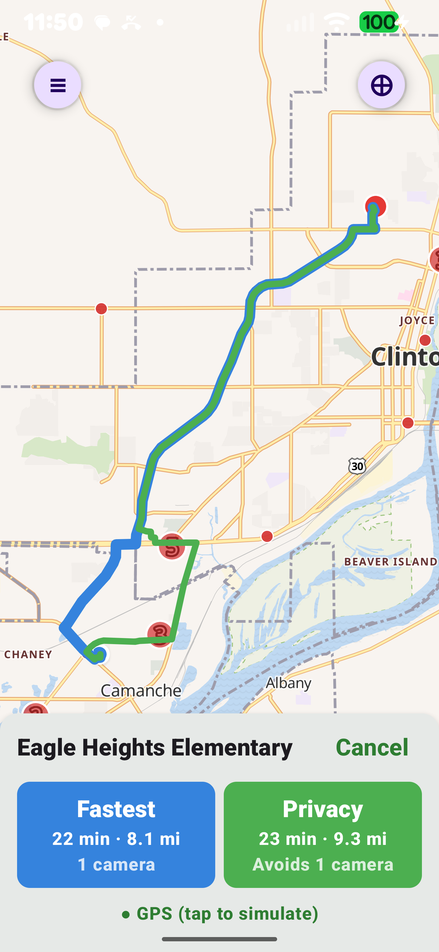
RedactedRoute app showing two routes to Eagle Heights Elementary in Clinton, Iowa: the fastest route at 22 minutes and 8.1 miles passing one ALPR camera, and the privacy route at 23 minutes and 9.3 miles — a clearly diverging detour around the camera for one extra minute. The map shows the two routes as separate loops around the camera cluster, with route cards comparing time, distance, and camera count.
The Problem
139,585
ALPR cameras logged in the United States

Automated License Plate Readers photograph every car that passes them — plate, timestamp, direction, sometimes make and model. The records feed private databases searchable by thousands of law enforcement agencies, insurers, repo firms, and HOAs. Usually without a warrant.

Most drivers never see the cameras. Most drivers don't know they exist. That's the point.

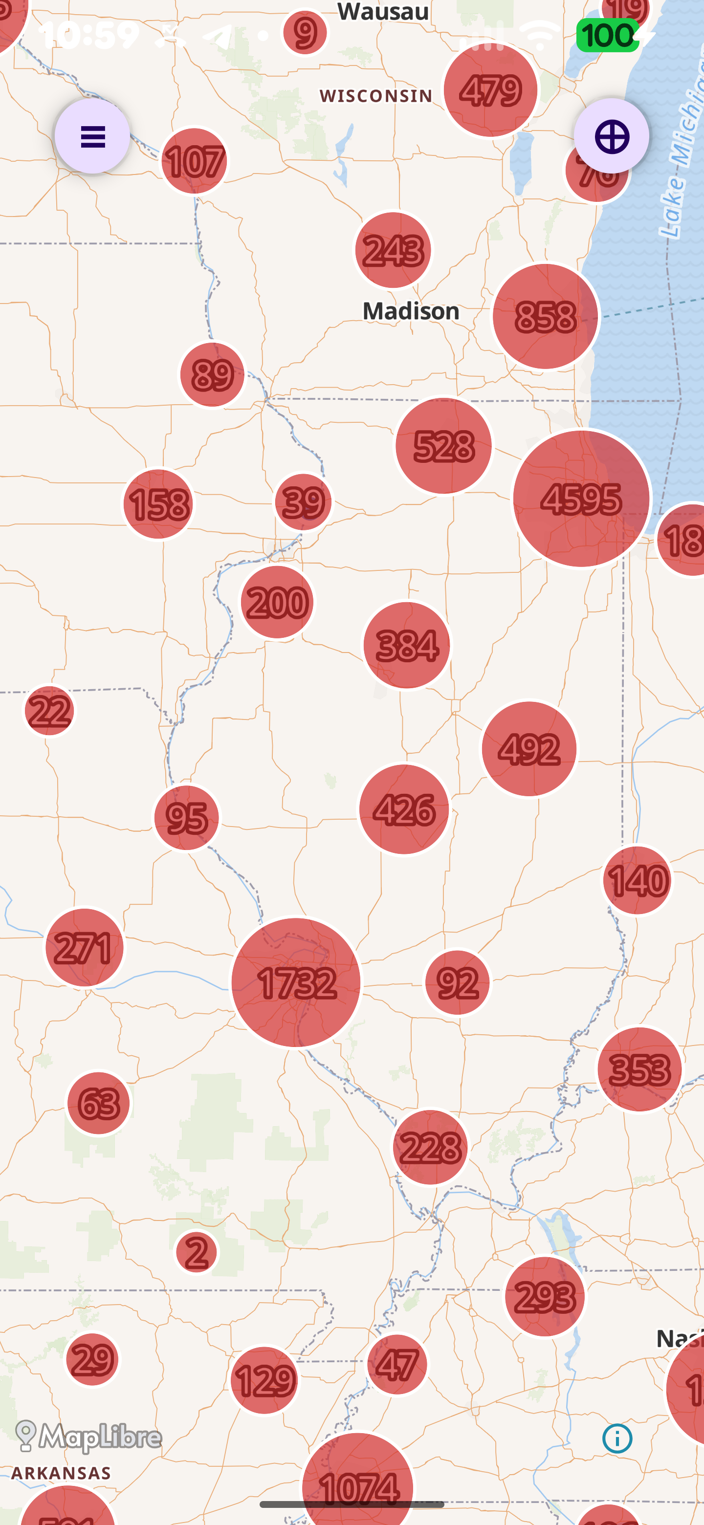
The RedactedRoute map zoomed out over the middle of the United States, showing red cluster bubbles with camera counts per region — thousands of ALPR cameras across Wisconsin, Illinois, Iowa, and beyond.
Live view from the app — every bubble is a cluster of mapped cameras
The Solution

Every trip. Two routes. You pick.

Type a destination. RedactedRoute calculates the fastest way and a privacy way that avoids known cameras. Both routes, side by side, with the trade-offs visible. Then you drive.

Fastest Recommended by traffic

8 min
Time
3.7 mi
Distance
5
Cameras

Passes five ALPR checkpoints. Each records your plate.

Privacy Recommended by RedactedRoute

9 min
Time
3.8 mi
Distance
0
Cameras

One extra minute. Zero plates logged.

What's in it

A real navigation app. Built for privacy from the ground up.

139,585 cameras mapped

Full DeFlock database bundled offline. No lookup calls.

Privacy route

Every trip generates a route that avoids known cameras.

Turn-by-turn nav

Full voice guidance, lane arrows, 3D buildings, day/night themes.

Android Auto

Full car display support. Coming in phase 2.

No account. No ads.

No sign-up. No trackers. No analytics SDKs. None.

28 languages

Voice prompts and route instructions in your language.

Works offline

Camera data is bundled in the app. No network call to find them.

Open-source stack

Ferrostar, MapLibre, DeFlock data, Valhalla routing. Self-hosted.

How it works

Three steps. That's it.

STEP 01

Search a destination

Type an address or a place. Autocomplete handles the rest.

STEP 02

Compare two routes

Fastest vs privacy, side by side. Time, distance, camera count.

STEP 03

Drive

Turn-by-turn voice guidance. Reroutes in 91ms if you deviate.

The app

Built on Jetpack Compose and MapLibre.

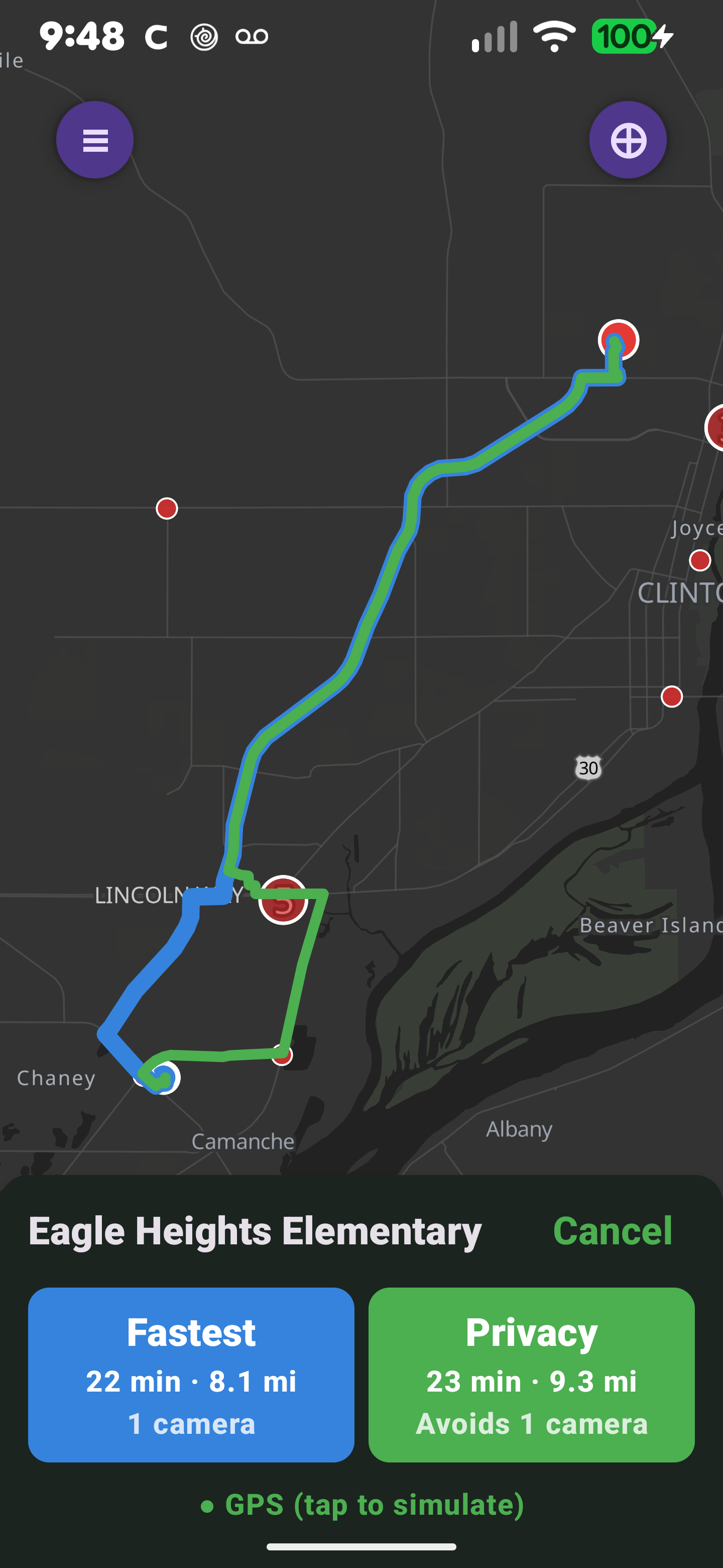
Dark map, red camera markers clustered by density, orange direction arrows on individual cameras, blue and green route lines drawn on top. Full 3D buildings at high zoom in cities. Bottom sheet with both routes ready to compare.

Questions? [email protected]

RedactedRoute app showing a route to Eagle Heights Elementary: a dark navigation map with red ALPR camera markers, the blue fastest route and the green privacy route diverging around a camera, and a bottom sheet comparing the two — Fastest 22 min · 8.1 mi · 1 camera, Privacy 23 min · 9.3 mi · Avoids 1 camera.
Privacy

What we don't do.

The whole point of the app is privacy. That starts with what RedactedRoute does not collect, store, or transmit.

Read the full privacy policy

  • NOAccount required. Nothing to sign up for.
  • NOAds. First-party or third-party.
  • NOThird-party analytics or trackers.
  • NOCrash reporting SDKs.
  • NONetwork call to look up camera locations. Data is bundled.
  • NORoute history uploaded to our servers.
  • NOSettings synced to a cloud account. They live on your device.
Tech

Built on open source. Hosted on our own metal.

No dependency on a third-party API that could change its terms, paywall its tiles, or shut down its routing service. The whole stack is open source and self-hosted, so nobody else gets to decide whether the app keeps working.

  • NavigationFerrostar
  • Map renderingMapLibre GL
  • Camera dataDeFlock / OpenStreetMap
  • Routing engineValhalla (self-hosted)
  • Map tilesPMTiles on Cloudflare R2
  • ClientJetpack Compose (Kotlin)